
The History of Cartography Newsletter Archive
Outreach 2025: newsletter, bookmark, and companion article, Nov. 2025
Volume Five, Cartography in the Nineteenth Century, is moving toward publication in the second half of 2027, both in print and as an e-book. The focus for our newsletter and online articles this year is the important nineteenth century phenomenon of the national, topographical survey. The newsletter includes a short piece by Project director Matthew Edney. He explores the topic further in an illustrated online essay, National Topographical Surveys and “Cartography,” where he takes a closer look at the national maps, their origins in the eighteenth century, their foundation on systematic, triangulation-based, territorial surveys, and their continuation into the twentieth century. He has supplied two small explanatory notes about the processes of triangulation and hydrographic mapping. (P.S. Check out the newsletter, especially because if you have a printer, you can make your own topographical bookmark!)
Outreach 2024: newsletter and companion articles, Dec. 2024
Volume Five is going to press in July 2025! Submitting the manuscript of Volume Five, Cartography in the Nineteenth Century, to our publisher, the University of Chicago Press, means we are at a major turning point—the volume will enter production in summer 2025, with expected publication in 2027! While we wait for publication, Dr. Edney has explored the topic of nineteenth century railroad mapping in the U.S. in an illustrated online essay, The Iron Road of Progress. Railroad mapping is just one of the many subjects covered in Volume Five. We highlight it here for its particular influence and importance during the period. The topic appears as a recurring theme throughout Volume Five and in a dedicated entry that includes essays from fourteen contributors that explore railroad maps and mapping around the world. (Edney has also prepared a brief introductory article on U.S. railroad mapping for the newsletter.)
Volume Five will have 410 entries, 4,778 citations, 1,054 illustrations! This year’s newsletter outlines the work involved in turning a complex, million-word work into a valuable, accurate, comprehensive, accessible, and elegant publication. There are two ways to learn more. Our step-by-step guide, Road to Publication, breaks down the process for preparing Volume Five: what the Project’s editorial team has completed over many years and what a reduced staff has to do before publication. Project Director Matthew Edney speaks to the question, What Does it Mean to Send Volume Five to Press?, clearly describing detailed volume assembly and production tasks and how they relate to this volume. Our publisher anticipates that production will take about two years. During that time, the History of Cartography Project must retain a small, but skilled staff. Volume Five is the last in the series and publication will bring the Project to a close. May we ask for your support at this end stage? Please make a gift at supportuw.org/giveto/histcart. Thank you.
Outreach Letter 2023: Internationalism in Cartography, Nov. 2023
Advanced editorial preparation of Volume 5 of The History of Cartography continues, and we are keeping pace with our timeline. Many entries show how mapmakers began to cooperate internationally during the nineteenth century and how this influenced the cartographic community. As technologies and networks developed, mapmakers realized that working collaboratively was the key to further cartographic achievements, like mapping the entire globe. In the 2023 newsletter, project director Matthew Edney writes about these early interactions, progress during the nineteenth century, and modern partnerships, including the History of Cartography Project. He develops the theme online in an extended, illustrated essay (geography.wisc.edu/histcart/2023-extras). The study of maps through a cultural lens provides insight into our past. The road was sometimes rocky for the nineteenth-century mapmakers who reached across boundaries, but Volume 5 topics also reveal successful efforts to connect. You, our readers and donors, are members of this community: as we continue our work to complete Volume Five and the series, we need your support more than ever. Visit our giving portal at the UW Foundation to set up a one-time or monthly donation. Enjoy the essays and thanks.
Outreach Letter 2022: Maps in the Public Sphere, Dec. 2022
One of the ways that The History of Cartography has contributed to the study of map history is in building up a community of support. By choosing to contribute to the Project, our authors make a conscious decision to support and to advance the field. By choosing to donate to the History of Cartography Project, our friends similarly support not just the people who maintain the rigor of the series but also to support the field as a whole. These actions are part of how we all participate in the “public sphere.” Project Director Matthew Edney expands on this point in an in-depth, illustrated essay on the place of geographical mapping within the public sphere. Maps were crucial to the formation of the public sphere in the seventeenth and eighteenth centuries, and further had a significant role in the fragmentation of the public sphere into multiple publics in the nineteenth century. Each public is a widespread community, held together by common references and common concepts; donating to the Project helps sustain the worldwide community of map aficionados. You’ll find the essay and maps online at geography.wisc.edu/histcart/2022-extras.
Outreach Letter 2021: Putting Maps Back into Context, Nov. 2021
This fall we address one element of the History of Cartography Project’s founders’ goals for the series: demonstrating the importance of the settings in which maps have been made and used. Our outreach letter narrows that focus to briefly—and literally—examine maps in context. How can we interpret maps that have been physically removed from their original settings or thrust into new collections? Project Director Matthew Edney has also researched and prepared an in-depth, illustrated essay, where he investigates maps taken from their original books and atlases. He shows that viewing maps in context is essential for interpreting them and understanding their makers and users. You’ll find the essay and maps online at geography.wisc.edu/histcart/2021-extras.
Outreach Letter 2020: Map we play…, Nov. 2020
As we reach out this fall, we offer a cartographic diversion from the unprecedented events of 2020. Here you will find a summary of how people have used historical map games and puzzles to distract, entertain, and educate. We include five compelling images as examples. Project Director Matthew Edney has also prepared a longer illustrated essay to provide an in-depth treatment of the relationship of cartography to games throughout the ages; it can be viewed at geography.wisc.edu/histcart/2020-extras.
Newsletter 2019: Nov. 2019
We are excited to announce publication of Volume Four and invite you to join us at launch events in Madison or Chicago this spring. This newsletter provides information about Volume Four that may surprise you (facts and fun!). It also includes a progress update for Volume Five and our annual call for funding. Three maps illustrate an article on the differences between boundary mapping and property mapping; it shows how Volume Four and the series as a whole help us think about the ways people have used these and other modes of mapping. More information about Volume Four, conferences, publications, and recent projects is available at: geography.wisc.edu/histcart/2019-extras
Outreach Letter 2018: Nov. 2018
Our 2018 outreach letter focuses on weather maps from the nineteenth century. During this period, scientists developed a new interest in and greater ability to collect data at multiple sites. This allowed cartographers to map changes in environmental conditions with increasingly more detail. Maps from Petermann (1850) and Johnstone (1888) demonstrate this, and the twenty-first century animated visualizations of global weather conditions show how far we have come.
Outreach Letter 2017: Nov. 2017
This year, we focus on historical globes: how they can change our worldview and how institutions have begun using interactive software to make images of them accessible online. This requires novel techniques to blend 2D digital representation with rotating 3D objects that were used as scientific instruments. Links to the collections discussed in the outreach letter and the websites of related projects are available at geography.wisc.edu/histcart/globes
Outreach Letter 2016: Nov. 2016
The 2016 outreach letter gives a schedule for completion of the series. It outlines the work that still needs to be done on Volumes Four and Five that are expected to appear in 2019 and 2022, respectively. The newsletter also shares information about Jean, or John, Palairet (1697–1774) and images of his folio-sized Atlas méthodique.
Outreach Letter 2015: Nov. 2015
The 2015 outreach letter looks at how satirical cartoons from early nineteenth-century Britain used maps to reference Napoleon’s global ambitions, including an image of a tiny John Bull defending Britain and Ireland against a giant Napoleon. The backside of this newsletter recognizes the Project’s supporters and thanks them for their donations.
Newsletter 2014: Fall, Nov. 2014
Preview of the Volume 6 jackets.
The cover of this newsletter provides a sneak preview of the Volume Six dust jackets; expect a spring 2015 release! This issue also shares information about Volumes Four and Five, including a Swedish manuscript map from 1650 that will appear in Volume Four. You’ll find pictures of Project staff and friends and reports on conferences and events from 2014.
Newsletter 2013: Fall, Oct. 2013
Cover image is an (imagined) view of the completed series. The articles and illustrations inside include: Volume news, including Volume Six manuscript statistics sure to astound; Map of New England, 1677 (1888 facsimile); Editors’ Activities; extracts from This Giddy Globe, 1919, from Oliver Herford, “Very Delightful Wit and Artist;” Funding News and How You Can Help; and Events and Fellowships. There are more than a few laughs in this issue—including Imre Demhardt’s tale about the international conference last summer—and there is some interesting news about an upcoming exhibit, Marginalia in cARTography. Follow the link and take a look.
Newsletter 2013: Spring, March 2013
In this year’s spring newsletter, friends of the Project can learn about our recent work on Volumes Four, Five, and Six—and there is a great deal of progress to report! Volume Six is going to Press in June and the Volume Five prospectus was submitted to external reviewers, which is the last step before review by University of Chicago Press Board of Publications. This newsletter touches on the editors’ recent talks, publications, and travels and tells of the upcoming ICHC conference (http://ichc2013.fi/) and reports on a recent symposium on Jean-Baptiste d’Anville. The names of our many kind sponsors and supporters have been removed from the online version of our newsletter, but they appeared in print and we sincerely appreciate their generosity. The cover features a sweet image from a nineteenth century text, in which two young people are shown studying basic elements of geography.
Newsletter 2012: Fall, Nov. 2012

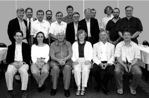
Presenters in the JCB’s “Cartographic Conversations” panel (left to right): Heidi V. Scott, Jordana Dym (Volume Four contributor), Susan Danforth (JCB deputy librarian and map curator), Carla Lois (Volume Five associate editor), Matthew Edney, and Jack Crowley. Photograph by Margot Nishimura.
This year’s fall issue offers updates on the final three volumes in our series and recent activities of the editors. Other articles include reports on several conferences and celebrations, news about the David Woodward Memorial Fellowship, a feature by editor Mary Pedley, and the introduction of a new Volume Four associate editor, Dr. Robert Karrow. An early twentieth century map depicting farmer John Byron Plato’s Clock System of identifying rural locations appears on the cover; inside you will find a detail of the Arctic Circle from a 1781 atlas, in which Philippe Buache presented his theories on the structure of the earth. Those new to the series may be interested in the concise listing of volume titles, publication dates, and editors on page three. Project news, including how friends can help support our work, is inside the back cover.
Newsletter 2012: Spring, March 2012
This newsletter updates readers on editorial activities underway for Volumes Four, Five, and Six of the series. In particular, it is exciting to relate that primary editing has been completed on all manuscripts for the twentieth-century volume (Volume Six); Madison office staff are fact and reference checking in earnest. Also here, news from the International Society for the History of the Map (ISHM), which was formally established in London, December 2011, and statistics about visits to and use of the new, online site for accessing Volumes 1 and 2 (press.uchicago.edu/books/HOC/). On the cover, a map that will appear in Volume Six: PopOut Map: The Georgian City of Bath ©Compass Maps Ltd. The print version of this newsletter included a page acknowledging our generous sponsors and individual donors by name. On the internet, we omit this page out of respect for our friends’ privacy, but we still offer heartfelt thanks!
Newsletter 2011: Fall, Oct. 2011
In this issue of the History of Cartography Project newsletter you’ll find exciting news about free online access to the first several books in the series; a report and many photos from the July 2011 International Conference on the History of Cartography in Moscow; progress reports on Volumes Four, Five, and Six; a special focus on the recently-appointed Volume Five associate editors; and a call for applications for the David Woodward Memorial Fellowship. On the cover, the Michelin Man, circa 1923, is shown rolling a tire across the globe. This newsletter also illustrates a detail from an early eighteenth century map of the town of Boston, which was published by merchant and map seller William Price, and a cinemap from the 1931 movie M, directed by Fritz Lang.
Newsletter 2011: Spring, March 2011
The History of Cartography Project is grateful to the many kind friends who provide financial support, and we devote a full page of the print version of each spring newsletter to listing their names in thanks. Because of this, the spring issues of our newsletter usually focus on progress reports for Volumes Four, Five, and Six. This issue is no exception. Of special interest in this issue is an early twentieth century public works snow removal map of Detroit, which is illustrated on the cover. As a snowy winter yielded to spring near the Project offices in Madison, Wisconsin, we especially enjoyed selecting this as our featured map.
Newsletter 2010: Fall, Sept. 2010

Roger Kain (Vol. 5 Editor), Jude Leimer (Managing Editor), Matthew Edney (Director and Vol. 4 Editor), Mark Monmonier (Vol. 6 Editor), Beth Freundlich (Project Manager), and Mary Pedley (Vol. 4 Editor) at an editorial meeting in Madison last fall.
In this issue, we introduce Peter Collier and Jon Kimerling, two new editorial assistants for Volume Six, discuss steps being made to provide digital access to the series, provide news on recent activities of the editors and Woodward fellow Carla Lois, and announce several upcoming conferences. The newsletter also provides the usual progress notes on forthcoming volumes in the series. Featured on the cover: a detail from Depth Curve Chart of the Adjacent Seas of Japan, 1952, which illustrates the relief contour (or illuminated contours) method of mapping developed by Kitiro Tanaka.
Newsletter 2010: Spring, March 2010
In addition to progress reports on Volumes Four, Five, and Six of the series, this newsletter briefly reports on the reopening of the newly expanded and reconstructed Osher Map Library at Project director Matthew Edney’s home institution: the University of Southern Maine. Volume Six editor Mark Monmonier is shown receiving the Mercator Medal from the Deutsche Gesellschaft für Kartographie last fall. Illustrated on the cover is a Russian Map of the surface of Phobos, a small satellite of Mars.
Newsletter 2009: Fall, Sept. 2009
This issue features a report on History of Cartography Project activities at the International Conference on the History of Cartography in Copenhagen, Denmark, July 2009. It also provides updates on Volumes Four, Five, and Six of The History of Cartography, including the exciting news that future volumes in the series will be published in full color. Another article examines the impact and use of our published volumes. Featured on the cover: 1728 map of Copenhagen.
Newsletter 2009: Spring, March 2009
Editors: Roger Kain, Mary Pedley, Matthew Edney, and Mark Monmonier.
News about Volumes Four, Five, and Six of The History of Cartography, Stéphane Blond’s recent resident fellowship with the Project, staffing in the Madison office, and general funding acknowledgements. This installment of our biannual newsletter also issues an invitation to those writing for The History of Cartography and all friends of the Project who plan to attend the 23rd International Conference on the History of Cartography (Copenhagen, July 2009). During the conference, editors Matthew Edney, Mary Pedley, Roger Kain, and Mark Monmonier are hosting an informal meeting, which will be held Tuesday, 14 July 2009, from 10:00 – 11:00 AM in seminar room Oktogonen E79 in the Royal Danish Library. No RSVP is necessary. On the cover, the first detailed map of prohibited airspace within Washington, D.C., published in 1935.
Newsletter 2008: Fall, Sept. 2008
Introducing Roger Kain, newly appointed editor of Volume Five, Cartography in the Nineteenth Century. Also included in this newsletter: progress and activities related to Volume Four, Cartography in the European Enlightenment, and Volume Six, Cartography in the Twentieth Century; report on the first review and award associated with Volume Three, Cartography in the European Renaissance; and notice of the 23rd International Conference on the History of Cartography (July 2009). Cover: UK Ordnance Survey map showing Exeter.
Newsletter 2008: Spring, March 2008
This issue provides updates on Volume Four, Cartography in the European Enlightenment, and Volume Six, Cartography in the Twentieth Century, and shares news and photos from a November 2007 reception held, in part, to celebrate publication of Volume Three, Cartography in the European Renaissance. Illustrated on the cover: the imaginary “Sea of the West” as published by Paris engraver and map seller Jean Lattré in 1762. Isaac Sáenz, this year’s David Woodward Memorial Fellow in the History of Cartography, is introduced here.
Newsletter 2007: Summer/Fall, Sept. 2007
On the steps of the faculty club of Istanbul University, April, 2007. From left: John Pedley, Mustafa Kaçar, Mary Pedley, Özgür Kolçak, Fikret Saricaoğlu.
We are pleased to announce publication of Volume Three, Cartography in the European Renaissance! Also in this issue, editor Mary Pedley looks back on a year of Volume Four activities, including trips to and meetings with authors at the Osher Map Library, the Miami Map Fair, Istanbul University in Turkey, the University of Michigan at Ann Arbor, and the International Conference on the History of Cartography (ICHC) in Berne, Switzerland. A Volume Six update highlights editor Mark Monmonier’s progress on the Twentieth Century volume and the recruitment of associate editors Karen Cook and Joel Morrison. Additional articles include a report on the 22nd ICHC (Berne, July 2007), news from the Madison office, information about numerous upcoming events in the field, and a detailed listing of volumes in The History of Cartography series. Applications are once again solicited for an annual two-month research fellowship in the history of cartography at the UW-Madison. Maps featured: a map of the western United States taken from an 1803 Ottoman atlas and a plan of the battle of Prut, 1711.
Newsletter 2006/07: Winter, Feb. 2007
Follow this link to preview the dust jacket design for Volume Three, which will be published during the summer of 2007. This newsletter also provides information on the final stage of preparing Volume Three (European Renaissance) for publication, updates on Volume Four (European Enlightenment) and Volume Six (Twentieth Century), and a brief history of how the Project began its broadsheet series of literary quotations on cartography.
Newsletter 2006: Summer, Aug. 2006
This newsletter provides an in-depth look at the many intellectual resources available to the History of Cartography editorial team and how we use them to improve accuracy in the published volumes. Also in this issue: progress reports on Volume Three (European Renaissance), Volume Four (European Enlightenment), and Volume Six (Twentieth Century); a report from Valeria Pansini on her research and residency in Madison as the 2005-06 David Woodward Memorial Fellow, staff and funding news, and notice of a procedural change for those who donate to the Project by mail. The cover features a chart of China’s southern coast from an ornate manuscript atlas produced around 1690 by William Hack, “A Description of the Sea Coasts… in the East Indies.”
Newsletter 2005/06: Winter, Feb. 2006
A brief update on the status of Volumes Three, Four, and Six; on the University of British Columbia’s 35th Medieval Workshop, held in Vancouver in October 2005, and on financial support for the Project (a list thanking those who made donations to the Project in 2005 has been omitted from the digital version of this newsletter). On the cover, Mark Monmonier uses a 7.5-minute quadrangle of Ossipee Lake, New Hampshire, to discuss how the United States Geographical Survey came to introduce “provisional maps” in the early 1980s.
Newsletter 2005: Summer, Aug. 2005

Above: Rosalind Woodward, wife of the late Dr. Woodward, accepted the Centenary Medal from RSGS President The Earl of Dalkeith at the President’s Reception and Awards Dinner, October 2004, in the Royal College of Surgeons, Edinburgh, in the presence of HRH The Princess Royal, who is a Vice-President and Honorary Fellow of the Society
New leadership! Matthew H. Edney has been appointed as director of the History of Cartography Project. In addition to updates on volumes in progress, this issue of our newsletter includes an interview with Dr. Edney; a thank you to Professor James E. Burt, who acted as interim director of the series; information about the David Woodward Memorial Fellowship in the History of Cartography; news from our editors, and conference updates. Cover image: Sebastian Münster’s map of Polonia et Vngaría from Ptolemy, Geographia Universalis (Basel: Henricus Petri, 1540).
Newsletter 2004/05: Winter, Feb. 2005
Follow this link for updates on History of Cartography Volumes Three, Four, and Six; information about the upcoming International Conference on the History of Cartography XXI; funding news (individual donor acknowledgments have been omitted from the web version of this newsletter); and an invitation for friends of the Project to suggest literary selections on cartography for future broadsheets. Illustrated here is a manuscript map showing routes for Anne of Cleves’s journey from Cleves to Calais in 1539 for her marriage to Henry VIII.
Newsletter 2004: Fall, Nov. 2004
Many, but not all, friends of the History of Cartography Project have heard the sad news that project director David Woodward died of cancer on 25 August 2004. In addition to the customary update on the status of volumes in the series and a few related features, this issue of our newsletter presents a tribute to the man who cofounded The History of Cartography and led it to world wide acclaim. It also signals our intention to continue work on the series following the methodology and exacting standards that David inspired. Obituaries: David Woodward, Arthur H. Robinson, and Paul Tierney. Features: Interview with Mary Pedley, coeditor for Volume Four, Cartography in the European Enlightenment; Madison office staff news; fellowship announcement; donor acknowledgements; and annual call for financial support. Featured map: Port of entry at Veracruz, Nicolás de Cardona, 1622.
Newsletter 2003/04: Winter, Feb. 2004
This newsletter contains brief updates on volumes in progress, a listing of the Volume Six board of advisors, funding news (individual donor acknowledgments appear in the print version of this newsletter, but not in this web version), and an invitation for friends of the Project to suggest literary selections on cartography for future broadsheets. The front cover shows David Woodward, History of Cartography founding coeditor, sitting on a marble replica of the Tasman Map of 1644 in the entrance hall of The State Library of New South Wales, Sydney, Australia.
Newsletter 2003: Summer, Aug. 2003
Participants in the Smith Center Summer Institute attending a lunch-time discussion on the History of Cartography Project.
Follow this link for progress reports on Volumes Three, Four, and Six, for an article about how we procure illustrations and obtain permission to publish images, and for news on editors’ activities this past year. This issue also includes a report from the International Conference on the History of Cartography (June 2003), staffing news, a call for applications for the Holzheimer fellowship, and information for donors or those considering making a contribution. Illustrated on the front cover: World map from “De Geographia,” by Henricus Glareanus, Basle, 1527.
Newsletter 2002/03: Winter, Feb. 2003
This issue provides statistics on the Volume Three manuscript, which went to press at the end of 2002, and it offers brief staff and funding news. For publication on the web, we have once again omitted the donor acknowledgements listed in the print version of this newsletter. This newsletter includes a Scandinavian map that will appear in Volume Three, Cartography in the European Renaissance.
Newsletter 2002: Summer, Aug. 2002
Features news and images from the Exploratory Essays Initiative on the History of Cartography in the Twentieth Century, tales from the final stages of preparing Volume Three for press, information about the encyclopedic format for Volume Four, a report from the April 2002 Renaissance Society of America meeting, and a description of the Map Society of Wisconsin’s tour of the History of Cartography Project. The Summer 2002 newsletter also includes an interview with editor David Woodward, volume editors’ and general staffing news, and reports on NEH and NSF funding possibilities.
Newsletter 2001: Winter, Feb. 2002
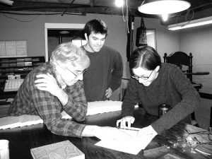
Printing of the History of Cartography Project broadsheet has become a winter tradition during the last ten years, with staff, family, and friends gathering for press work at Director David Woodward’s home. At work above, left to right: UW Geography graduate student and long-time Project illustrations editor Dana Freiburger, with reference editors Ben Sheesley and Kim Coulter.
Includes reports on the upcoming symposium on the history of cartography in the Twentieth Century, the first Holzheimer Fellow in residence at the University of Wisconsin, and poet Moira Roth’s contribution to our 2001 broadsheet, numbered ten in the series. This issue also includes funding news (individual donor acknowledgements appear in the print version of this newsletter, but not in this web version), recent reviews, and bibliographic information on several new books published in the field.
Newsletter 2001: Summer, Aug. 2001
Reports on a very busy year for the Project, from the first half of 2001 to the fall and early winter ahead. This issue includes Project news, a round-up of past and upcoming events and activities involving editor David Woodward and other staff. Also included: an announcement of the volume published recently in Barcelona on a lecture series detailing methodological issues raised by the Project; an interview with managing editor Jude Leimer; updates on Volumes Three, Four, and the Exploratory Essays Initiative (EEI) for Volume Six; recent reviews; Madison staff news; and notable publications and awards for several Project editors and authors.
Newsletter 2000: Winter, Feb. 2001
This issue includes volume status updates for Volumes Three, Four, and Six, including a list of presenters at the twentieth century cartography special sessions of the 2001 American Association of Geographers (AAG). Also includes staff news from the Madison office, Project funding news, and a brief biography of Lucia Perillo—who wrote this year’s commissioned broadsheet selection. This newsletter features a 1573 map of the route of Don Lope de Acuña through the Franche-Comté.
Newsletter 2000: Summer, Aug. 2000
Exploratory Essays Initiative meeting, Chicago, June 2000. Standing: Mark Monmonier, Alexei Postnikov, Joel Morrison, Dan Montello, David Woodward, Mike Heffernan, Chris Board, Ferjan Ormeling, Peter Collier, John Cloud, Pat McHaffie, Waldo Tobler. Seated: Bob McMaster, Carme Montaner, Fraser Taylor, Karen Cook, Ulrich Freitag, Alastair Pearson. Missing from photo: Jim Akerman, Ingrid Kretschmer, Susanna McMaster.
Reports on our two recent conferences: Cartography in the European Renaissance (April 2000) and the Cartography in the Twentieth Century Exploratory Essays Initiative planning meeting (June 2000). This newsletter also includes information about cartographic panels to be held at the History of Science Society’s November 2000 meeting and the Renaissance Society of America’s Spring 2001 meeting, series editor news, staffing news from the Madison office, and other announcements.
Newsletter 1999: Winter, Feb. 2000
Describes the Breasted Prize, which was awarded to Volume Two, Book Three, introduces the three co-editors for Volume Four, and lists the Volume Six advisory board members. Also includes a preliminary program for the Burdick-Vary symposium on Renaissance cartography, updates on David Woodward and Mark Monmonier’s activities, staff changes, and funding news. Follow this link for information about establishing a bequest to benefit the Project. Illustrated in this newsletter is the St. Gallen Cosmographical Globe, ca. 1575.
Newsletter 1999: Summer, Aug. 1999
This newsletter is the first of our summer newsletters, which will give you a more detailed look at forthcoming books, our research methods, upcoming events in the field, and Project staff. This issue describes Volume Three and its interpretive essays, explains how we reference-check manuscripts, announces recent grant awards, explains the early bibliographic process followed for Volume Six, announces a symposium on Renaissance cartography to be held 6-9 April 2000, and interviews Samir Murty, an undergraduate student whose research examined variations in the 1482 and 1486 editions of the Ulm Ptolemy atlases. Included here is the magnificent Carta Marina, by Olaus Magnus (1539).
Newsletter 1998, Feb. 1999
Includes volume updates, a full list of Volume Three advisory board members and their affiliations, staff news, and funding news. Follow this link to view both François Ollive’s map of the Mediterranean, ca. 1664, and an illustration depicting geometrical instruments from G. G. Kraill von Bemebergh’s work Tractatus geometricus et fortificationis (1618).
Newsletter 1997, Feb. 1998

Editor Mark Monmonier speaking at the 1997 Volume Six planning conference.
In this issue, look for volume updates, information about a special session at the SSHA meeting in November 1998, news from the Volume Six planning conference, staff news, and funding news. Volume Six coeditor Mark Monmonier is pictured here, speaking to the assembled participants of our 1997 conference.
Newsletter 1996, Feb. 1997
Contains volume updates, an interview with G. Malcolm Lewis, coeditor for Volume Two, Book Three, staff news, and funding news. Image represented is a Map of Don Miguel Damain’s properties, ca. 1576.
Newsletter 1995: December, PDF
Newsletter 1994: December, PDF
Newsletter 1993: December, PDF
Newsletter 1992: December, PDF
Newsletter 1991: December, PDF
Newsletter 1990: December, PDF
Newsletter 1989: December, PDF
Newsletter 1988: December, PDF
Newsletter 1987: December, PDF
Newsletter 1986: December, PDF
Newsletter 1985: December, PDF
Newsletter 1984: December, PDF
Newsletter 1982: December, PDF
Newsletter 1982: May, PDF
Newsletter 1981: December, PDF
Please note that although newsletters were published twice a year from summer 1999 through fall 2013, we returned to producing just one newsletter per year beginning with the fall 2014 issue.